LiDAR –Technology for Laser Terrain Scanning
03/09/2018
LiDAR or Light Detection and Ranging is a method in geodesy for measuring range to target with the help of laser beams. The data gathered with LiDAR scanning can be used to build high quality maps in geodesy, geomatics, archaeology, geography, geology, geomorphology, seismology, forestry, and more.
During the Autumn in 2015 the Ministry of Environment and Spatial Planning finished a project of Laser scanning Slovenia. In the same year the data was processed and prepared for further usage. With that project the most precise terrain profile was created for Slovenia.
The process of laser scanning terrain is essentially a process to collect point data with the help of a laser scanner mounted on an airplane. The scanner emits and subsequently collets the laser beam that was reflected from the earths surface. Based on the time travelled the precise elevation of each point is determined. The key for this is the integration of three different pieces of equipment: GNSS navigation devices (Global Navigation Satellite System), inertial system (INS), and the laser scanning system. The first two systems that are added to the laser scanners are meant to place the data collected into space. A great advantage with such data scanning techniques is not only data precision but also a lower dependency on weather since it uses electromagnetic waves. It is not interfered by weather conditions, can penetrate vegetation, and allows data scanning at night.
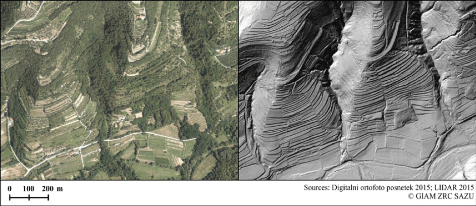
left a digital orto-photo terrain scan, right a laser terrain scan with LiDAR
The result of laser scanning is a cloud of georeferenced points, that are further processed by classifying them based on the surface from which the beam was reflected (surface type, low or high vegetation, building, road, water, etc.). With this classification a digital model of the terrain is established. The precision depends mostly on the density of reflected points (number of points per square meter).
Most of Slovenia was scanned with the density of 5 points per square meter (first reflection), the high mountain range areas and forest areas 2 points per square meter (sketch below). Some high-risk areas for flooding and landslides were scanned with 10 points per square meter precision.
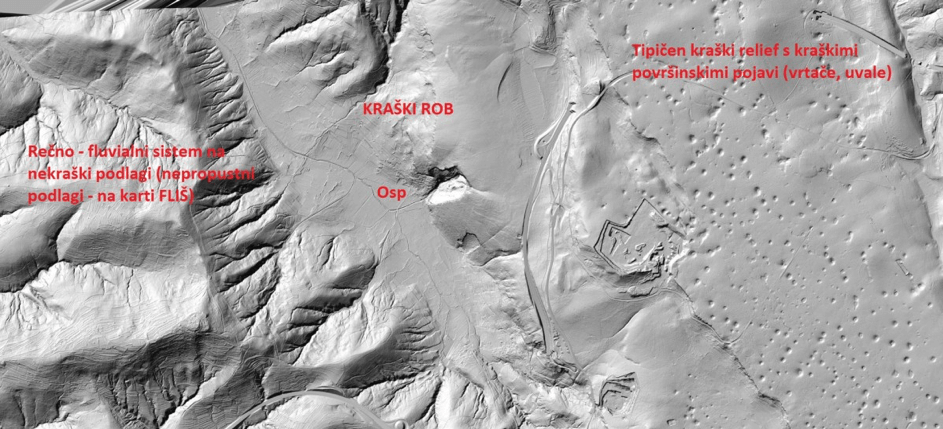
An example of LiDAR scans of Kras
The data collected via laser scanning can be used in a wide variety of areas, especially where a very detailed and precise terrain model is a prerequisite. The main purpose for the project in Slovenia was hydraulic analysis of water conditions, mapping flooding dangers, flooding area simulations, designing antiflooding protocols, and designing/organizing spatial data. Generally, the usefulness of LiDAR technology is limitless and still mostly undiscovered.
LiDAR data can be used for things such as:
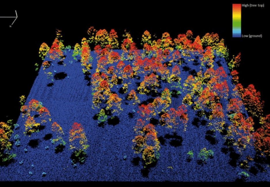
LiDAR scans can be used for vegetation and forest density analysis
At Monolit we use LiDAR data to determine axis and slope of roads that travel through forest areas and are covered by vegetation namely because we cannot determine those elements via classic digital orto-photo satellite imagery. With LiDAR scans road segments in forest areas are easily defined.
Data collected with LiDAR technology for Slovenia are free and available through a web service Atlas environment, which is part of the Slovenian Environment Agency that falls underneath the Ministry of Environment and Spatial Planning.
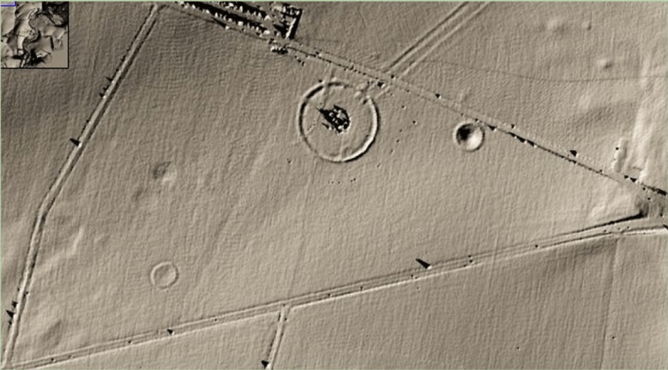
LiDAR scans of Stonehenge archaeological site in England


